
P-22 was here
P-22 was here
How to hike to a spot where he was once photographed.


Beth Pratt posted this photo to Twitter just after P-22 died. I hadn’t seen it before. It’s part of Steve Winter’s iconic series on the cougars of North America, and it shows our friend P-22, in his younger days, looking out over the 134 freeway as it winds toward Glendale.
I recognized the spot where this was taken, immediately. During COVID I spent an awful lot of time exploring Griffith Park (hiking was basically the only thing I could do), and got to know the place in minute detail, including the names of the trails and where each of them go. I’d been past this view dozens of times. It’s off the Skyline Trail.
It struck me as a fitting tribute to say goodbye to P-22 by standing in a place that I knew P-22 once stood, and looking out at a vista that he once looked out at. There are two ways to get up here —there’s a long way and a short way.
The Long Way
The long way is just shy of 2 miles long but it is far more scenic than the short way (which is maybe 1,500 feet). The long way takes you past a handful of iconic Griffith Park sites which, when I hiked past them on Friday, seemed to have new context by virtue of P-22’s addition to the pantheon of park history.

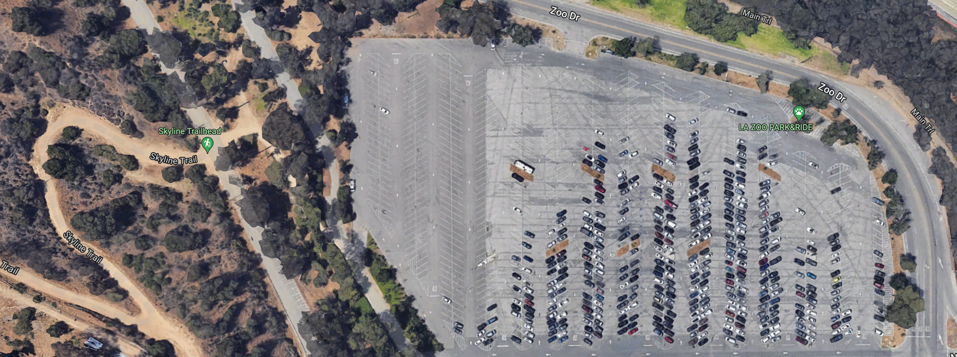
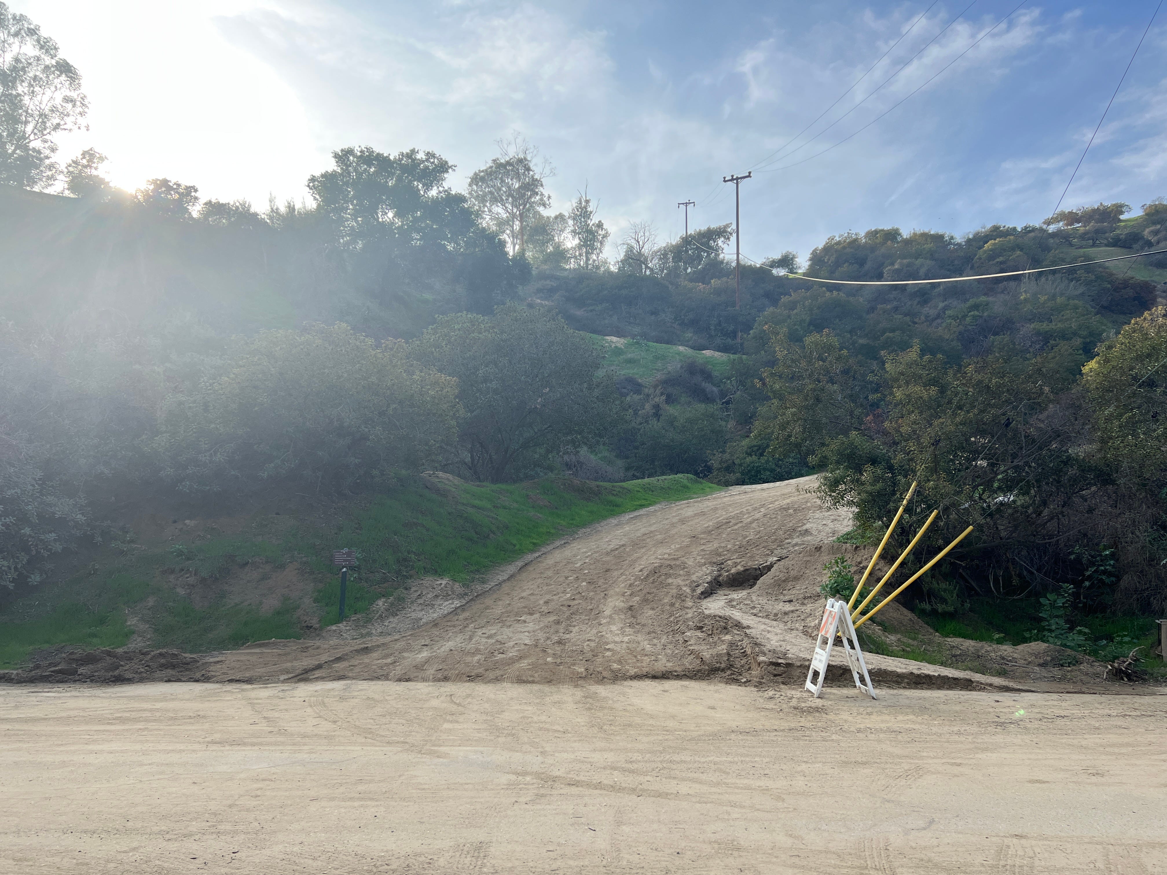
The long way starts at the Travel Town parking lot, on the Burbank side of the park, where Griffith Park Drive springs off Zoo Drive. You can park in the Travel Town lot, though there’s also a small dirt lot just to the south. Griffith Park Drive was recently closed off to cars, and there’s usually someone guarding the barriers to make sure you don’t drive up there, and sometimes they will let you into the dirt lot and sometimes they won’t.
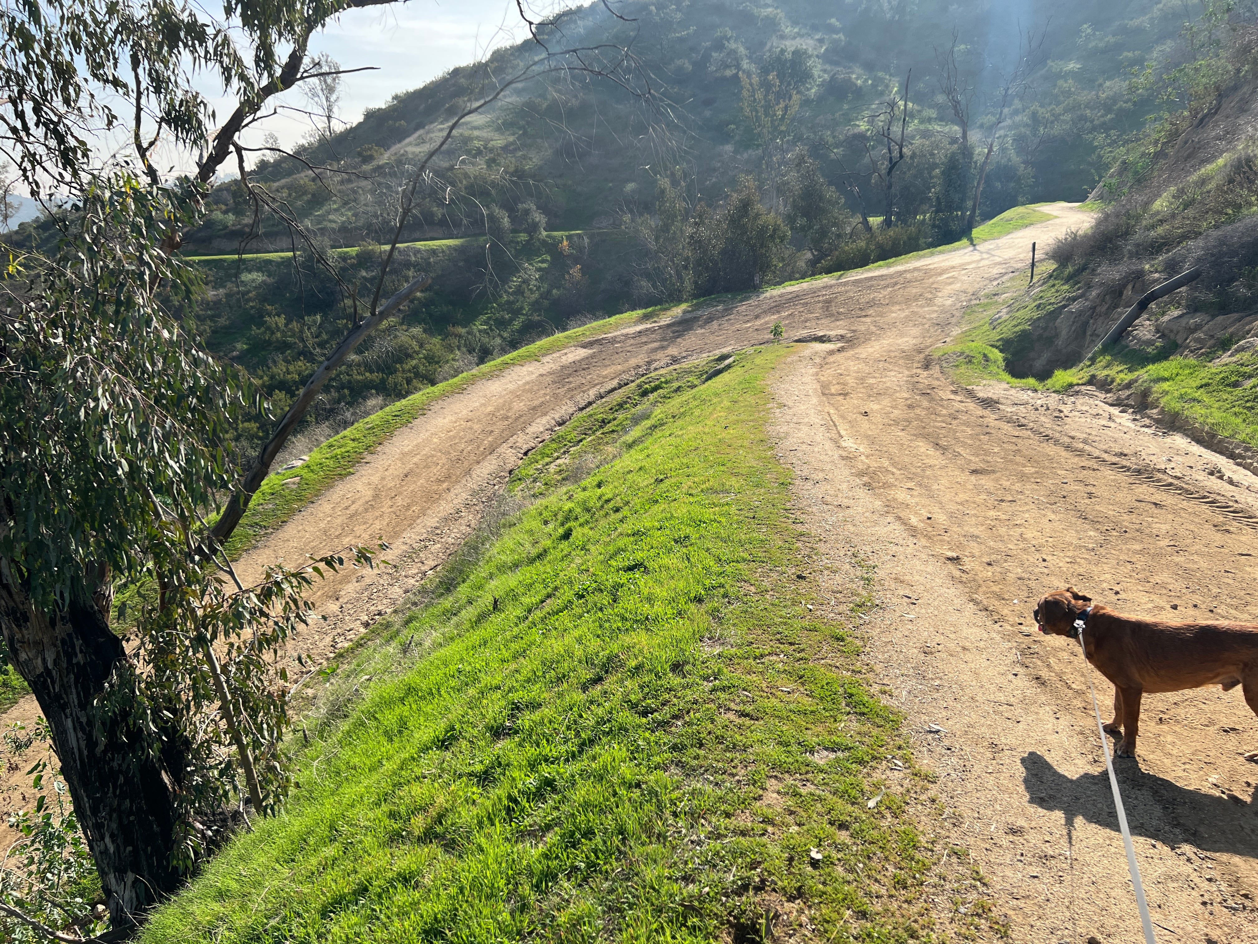
The Skyline Trail starts just south of the little dirt lot. It is, initially, a bit steep, but it evens out pretty quick.
Go up the trail, around a hairpin turn to the left, then around a wider turn to the right, and then around another bend to the right. Along the way, you’ll see the massive Headworks Reservoir, still under construction, which broke ground in March, 2012 —less than a month after P-22 was first discovered in Griffith Park. The reservoir is now named for Tom LaBonge, another beloved local spirit animal from days gone by.
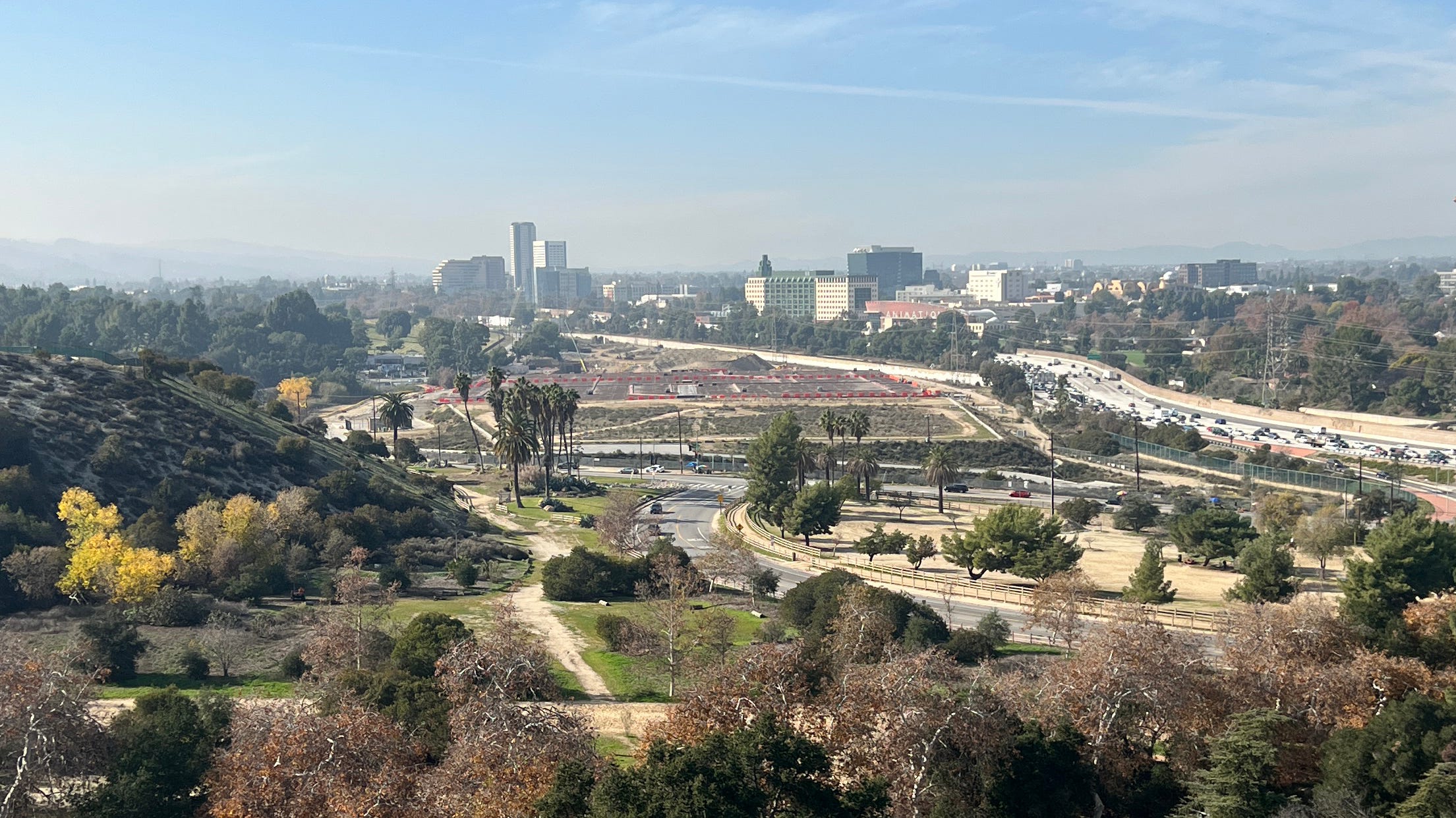
You will also pass above Travel Town, with the Los Angeles Equestrian Center in the background. The Equestrian Center is considered part of Griffith Park even though there’s a river and a freeway separating it from the rest of the park. I do not believe that P-22 ever ate a horse, which was probably out of respect.
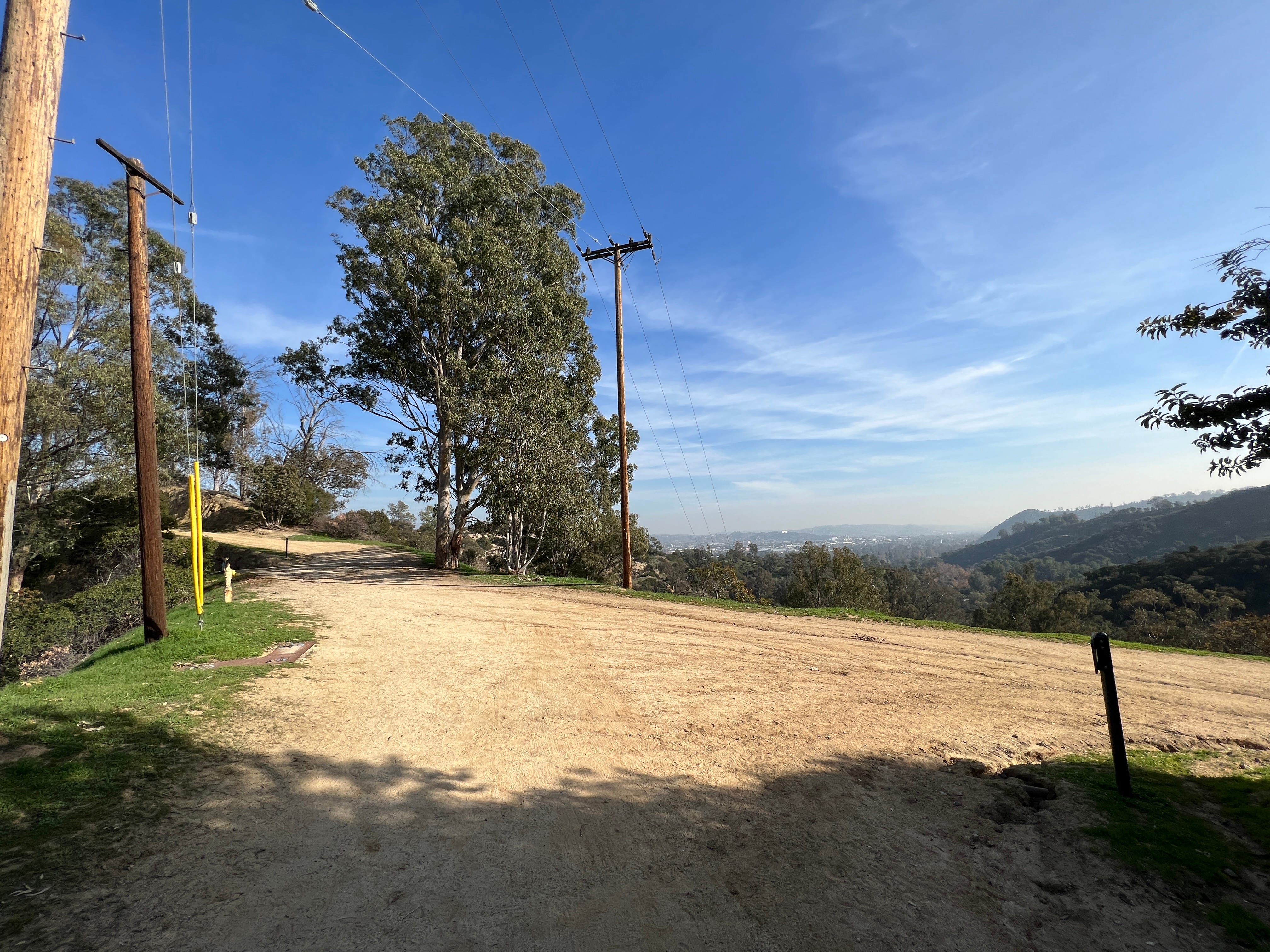
Roughly a half mile from the trailhead, you’ll get to an intersection. Go left, toward the zoo.
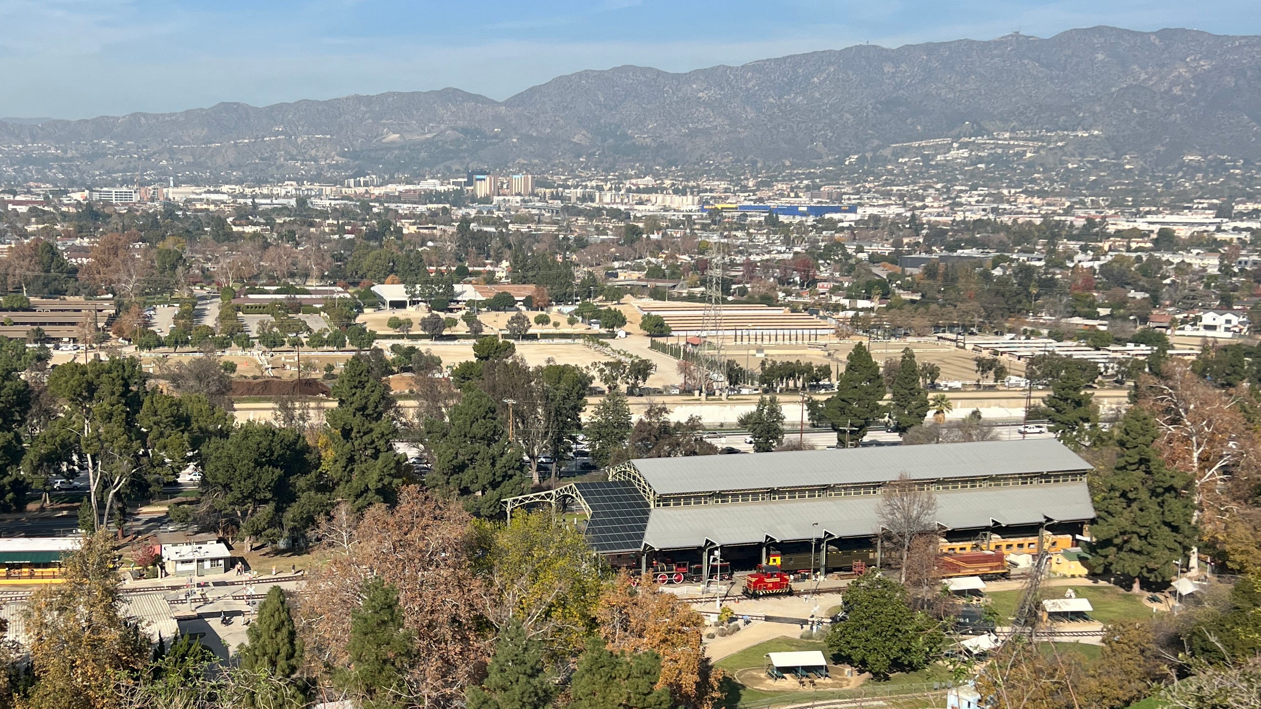
Along this stretch of the Skyline Trail you’ll get another view of Travel Town, where, if you look closely, you can spot the Carolwood Barn built by Walt Disney, the creator of several other Los Angeles spirit animals.


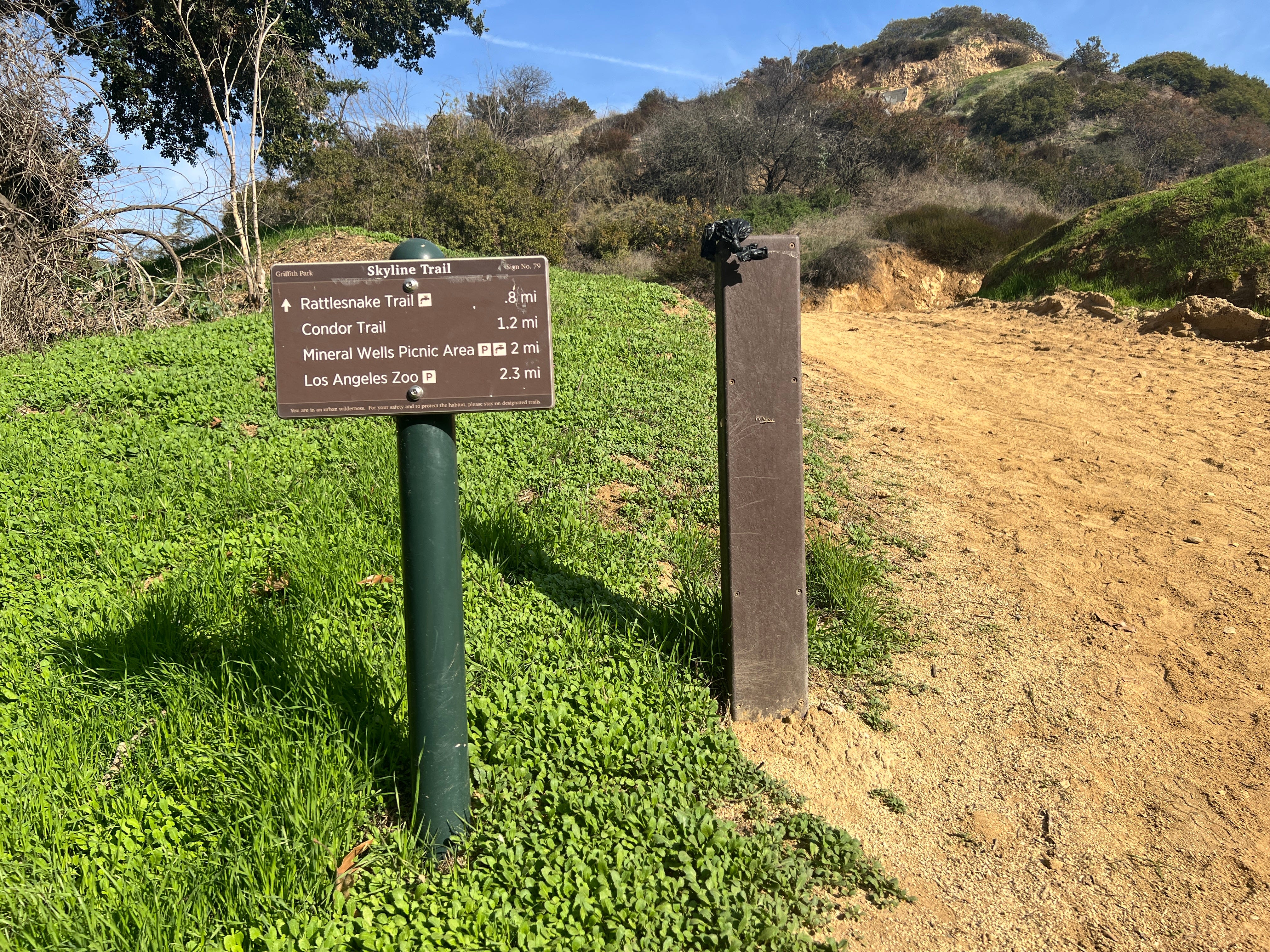
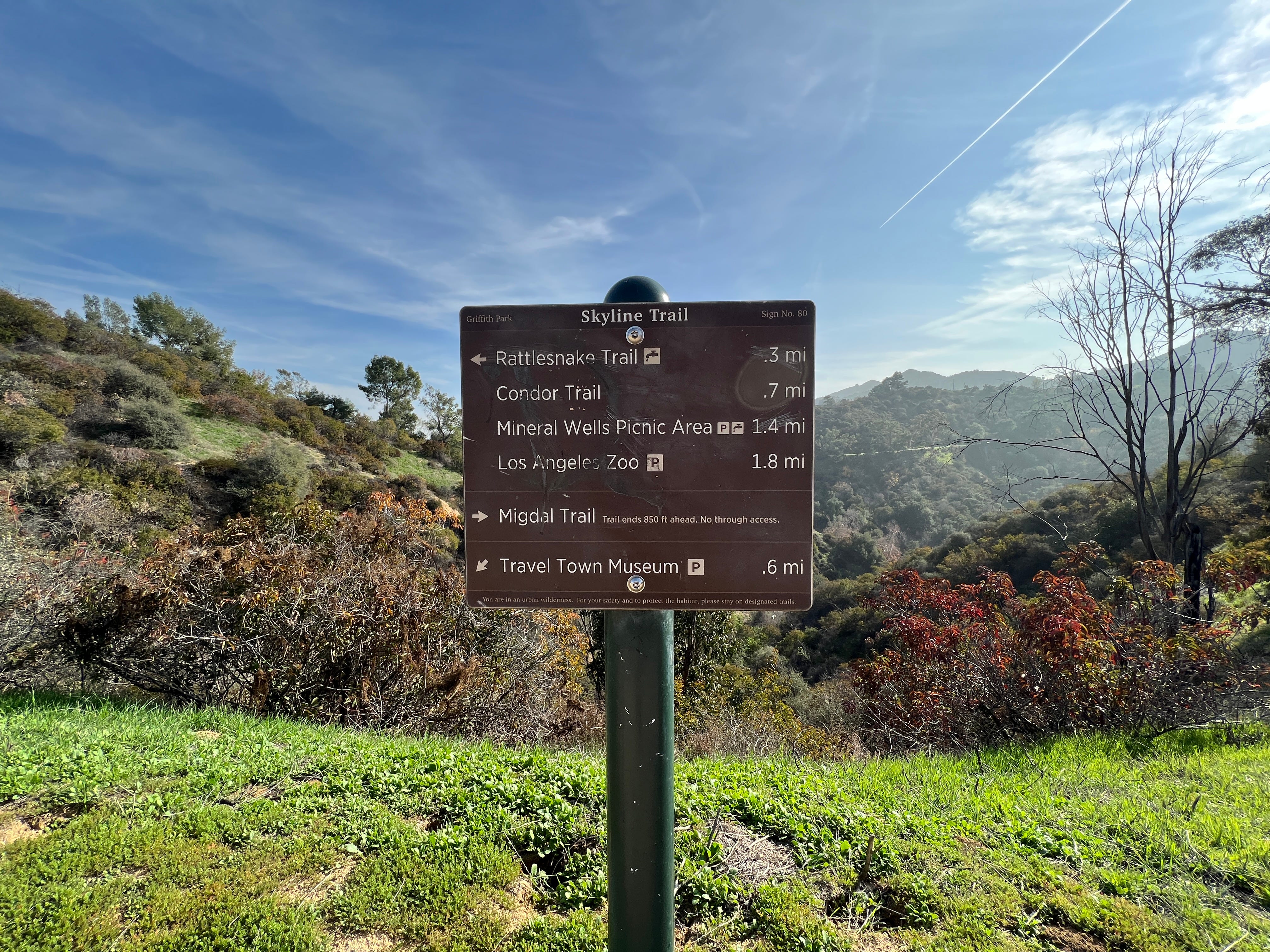
A quarter mile from the last intersection you’ll come to another one, where the Rattlesnake Trail crosses the Skyline Trail.
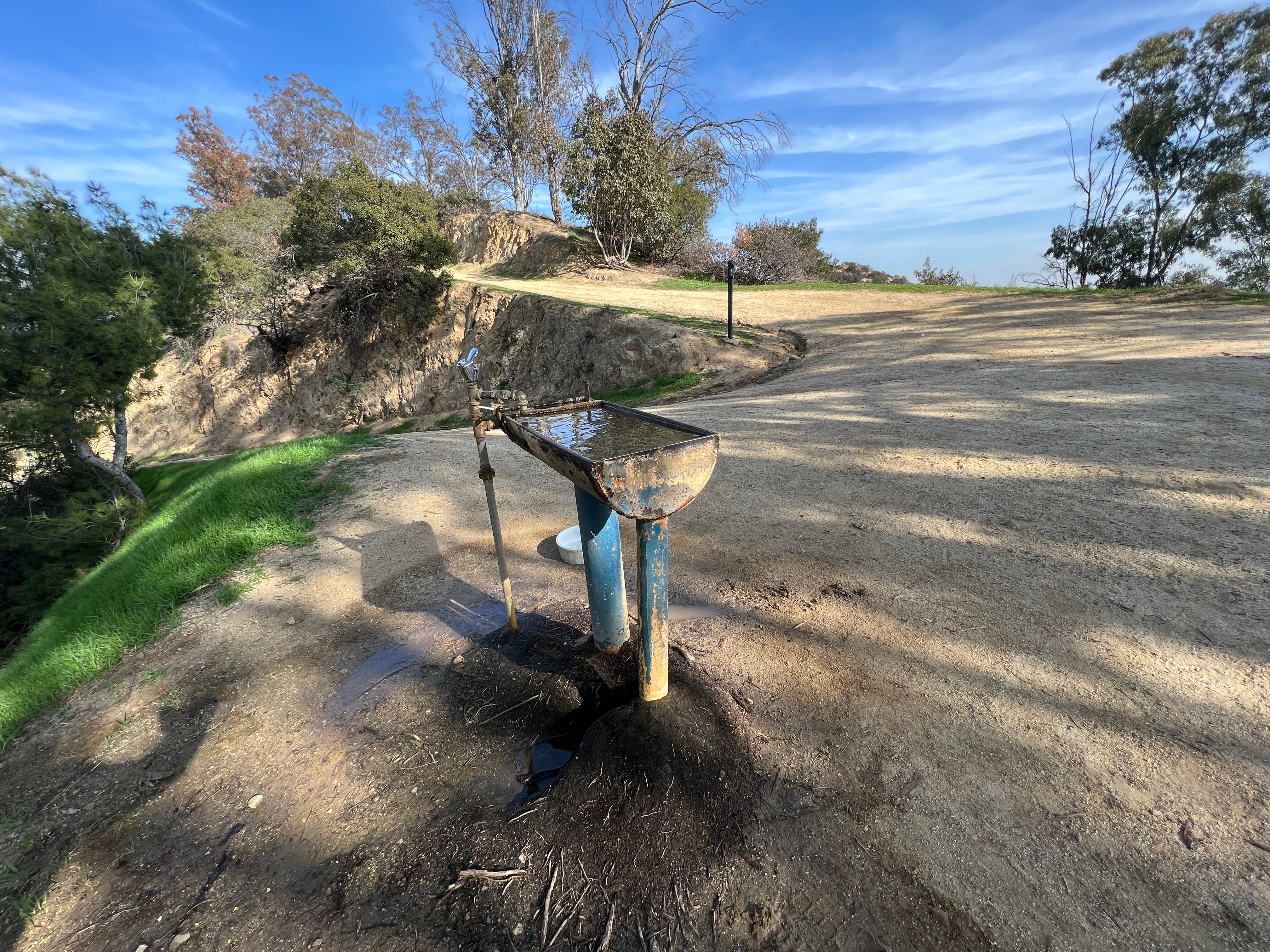
Veer to the left, and when you see the blue horse trough, follow the trail that goes up, not down.
You'll pass a fork; stay left.
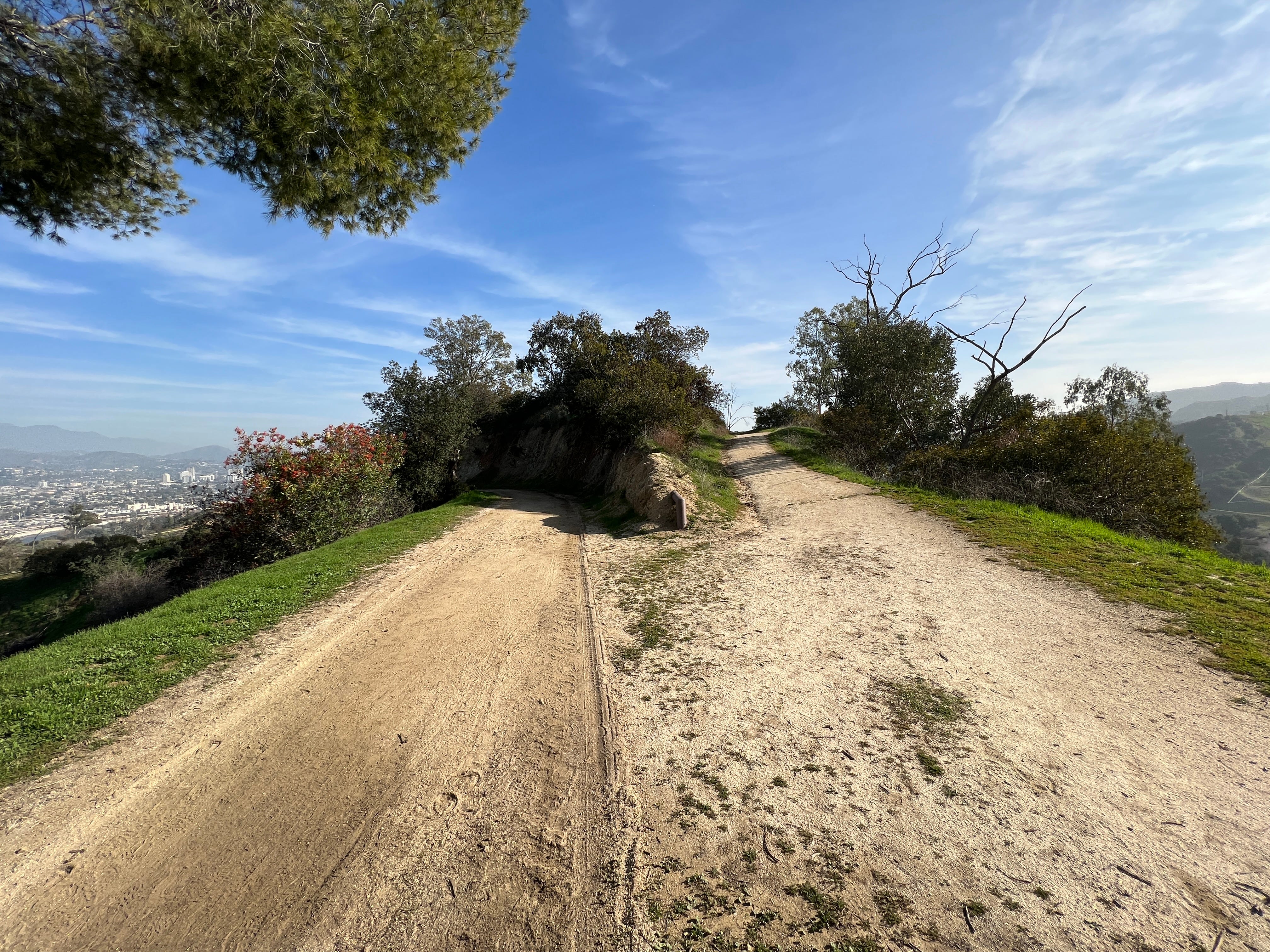
And then, little more than a third of a mile from the blue horse trough, you’ll come to this intersection.
Continue left, staying on the Skyline Trail.
(If you go to the right, that’s the Condor Trail, which goes down to the Mineral Wells Picnic Area. There’s a tree at Mineral Wells where @GPMountainLion once performed his dark rituals.)
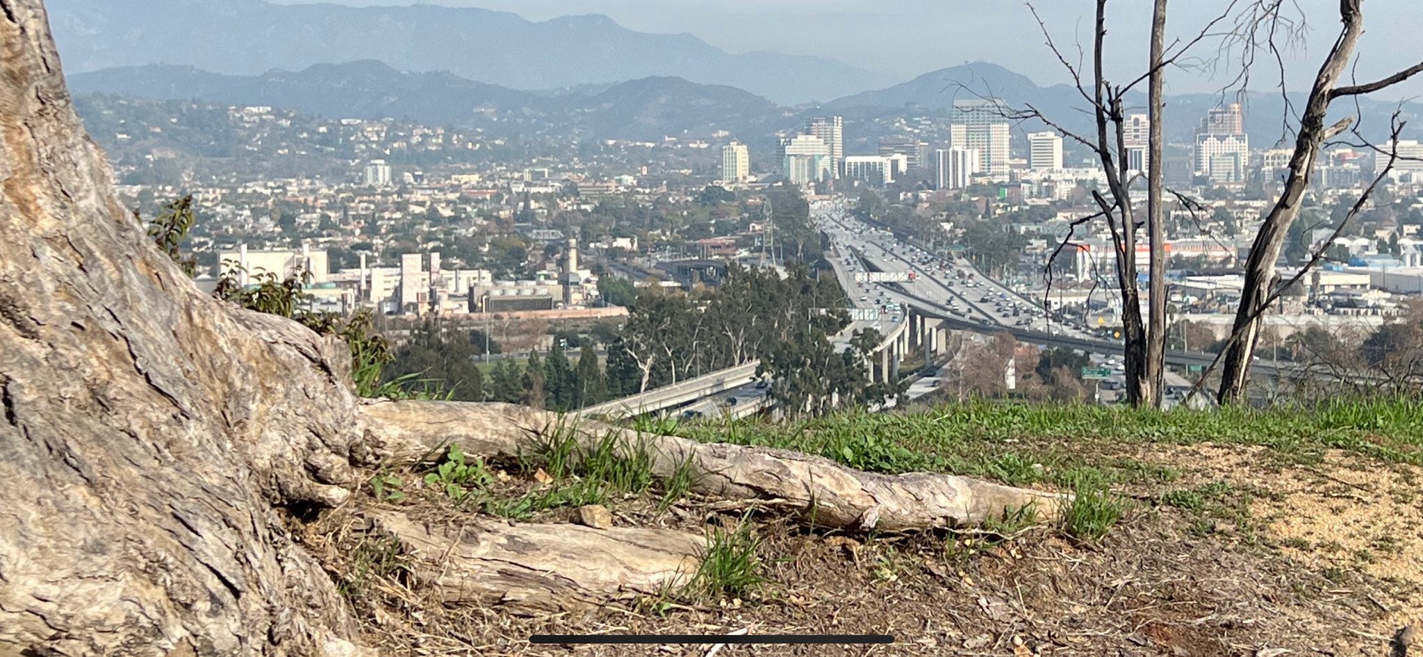
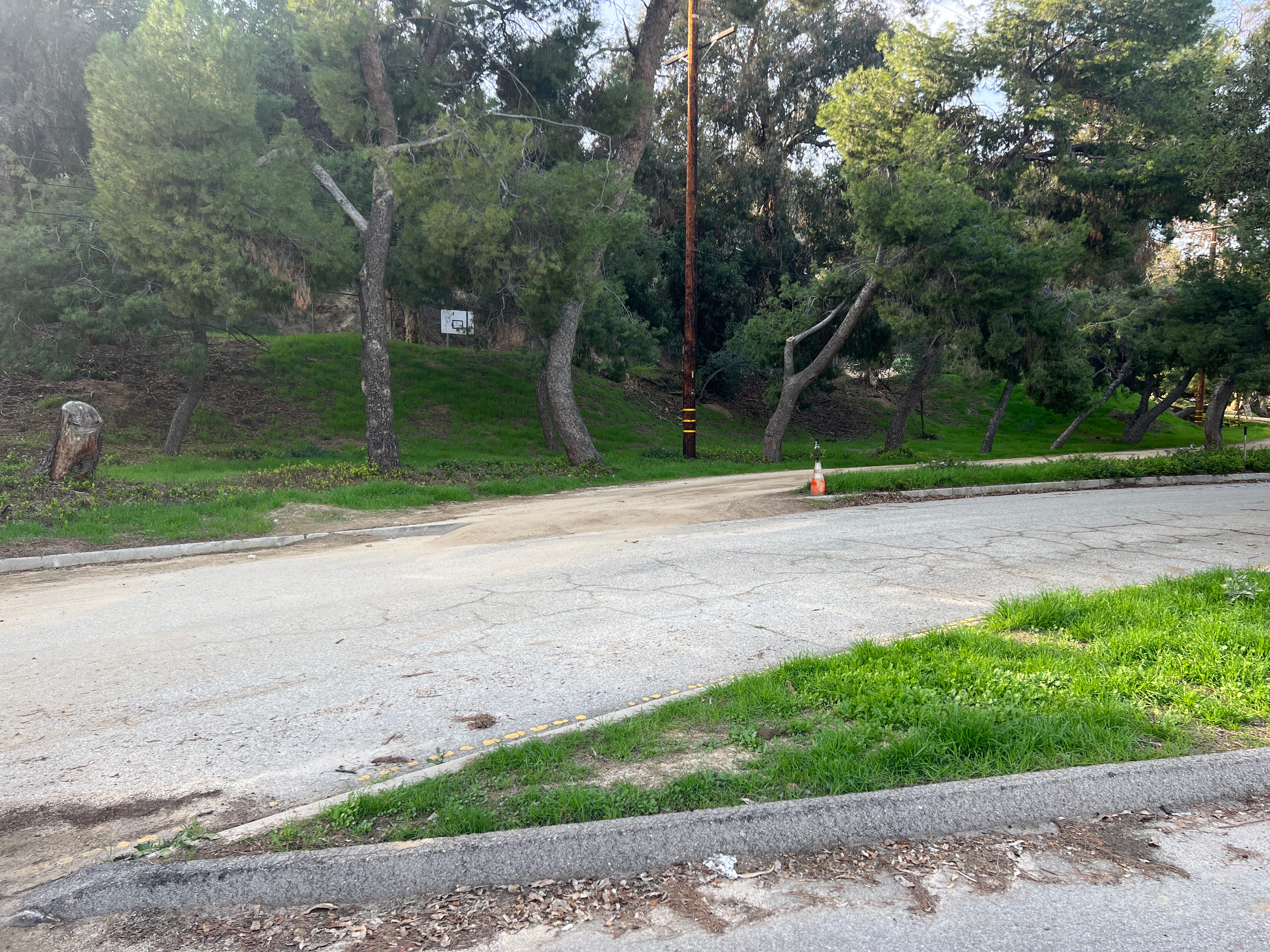
After another half mile you’ll get to the outskirts of the Los Angeles Zoo. You’ll know it by the big fence that stretches along the right side of the trail —the zoo is on the other side of that fence. When you see it, you’re close to spot where P-22 was photographed. Keep going until you see this tree stump up ahead. (There’s a few tree stumps —it’s the largest one.)
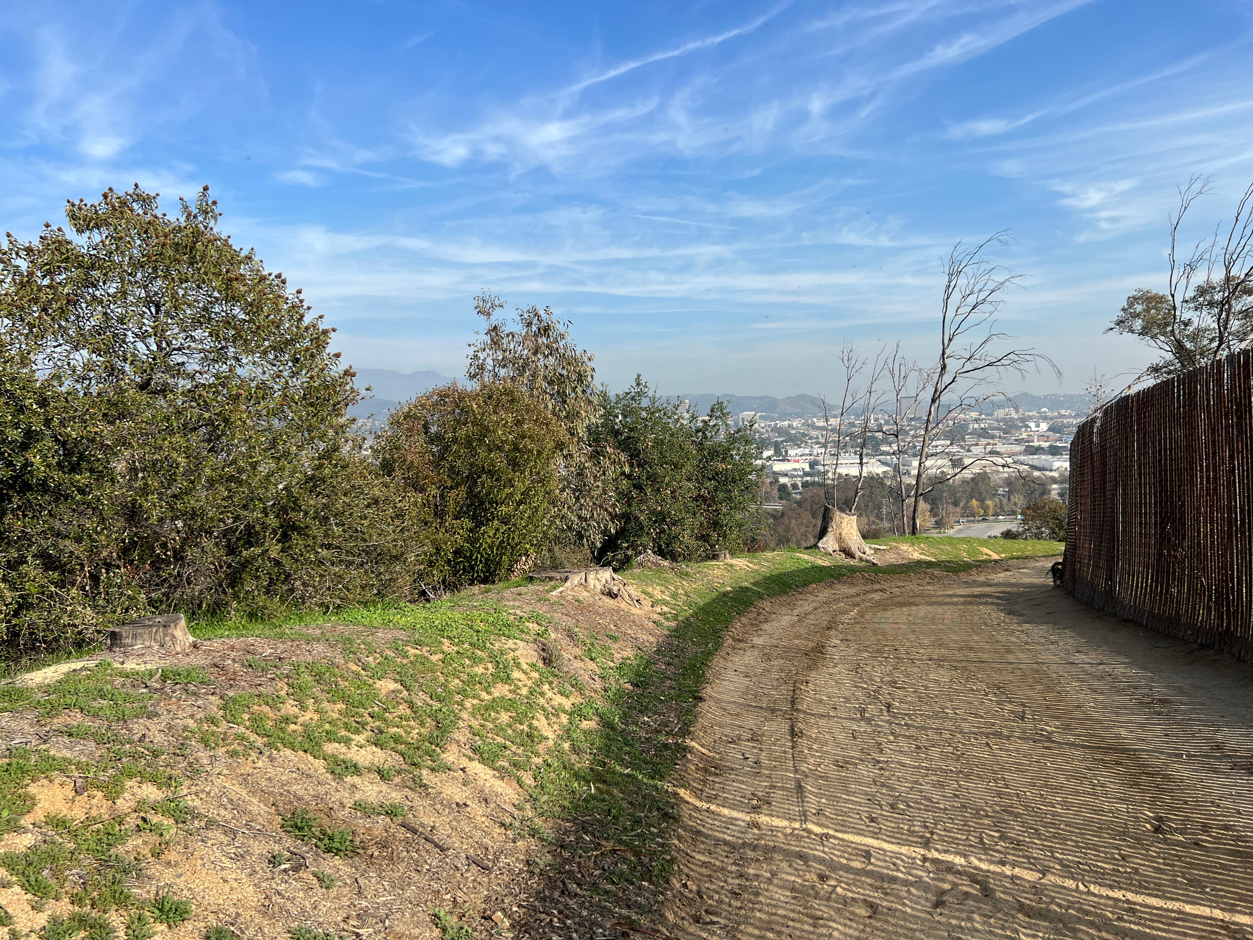
The tree stump sticks out of a little ridge, and along that ridge, just to the right of that tree stump, that’s the spot.

P-22 was here.
If you make it up here in the next week, there’s a beautiful little hillside just past the ridge. It’s full of green grass from the big rain we had a few weeks ago. It’s a good place to sit and think about P-22, and reflect on how the zoo is right behind you, and how Steve Winter’s photo was taken not long before P-22 got in and ate a Koala. We didn’t know it at the time, but P-22 was casing the joint.
The Short Way
The short way, as mentioned above, is only about 1,500 feet long. It starts in the northwestern-most corner of the zoo parking lot, where you should find an abundance of empty spaces.
Keep an eye out for these five yellow poles at the western edge of the lot.
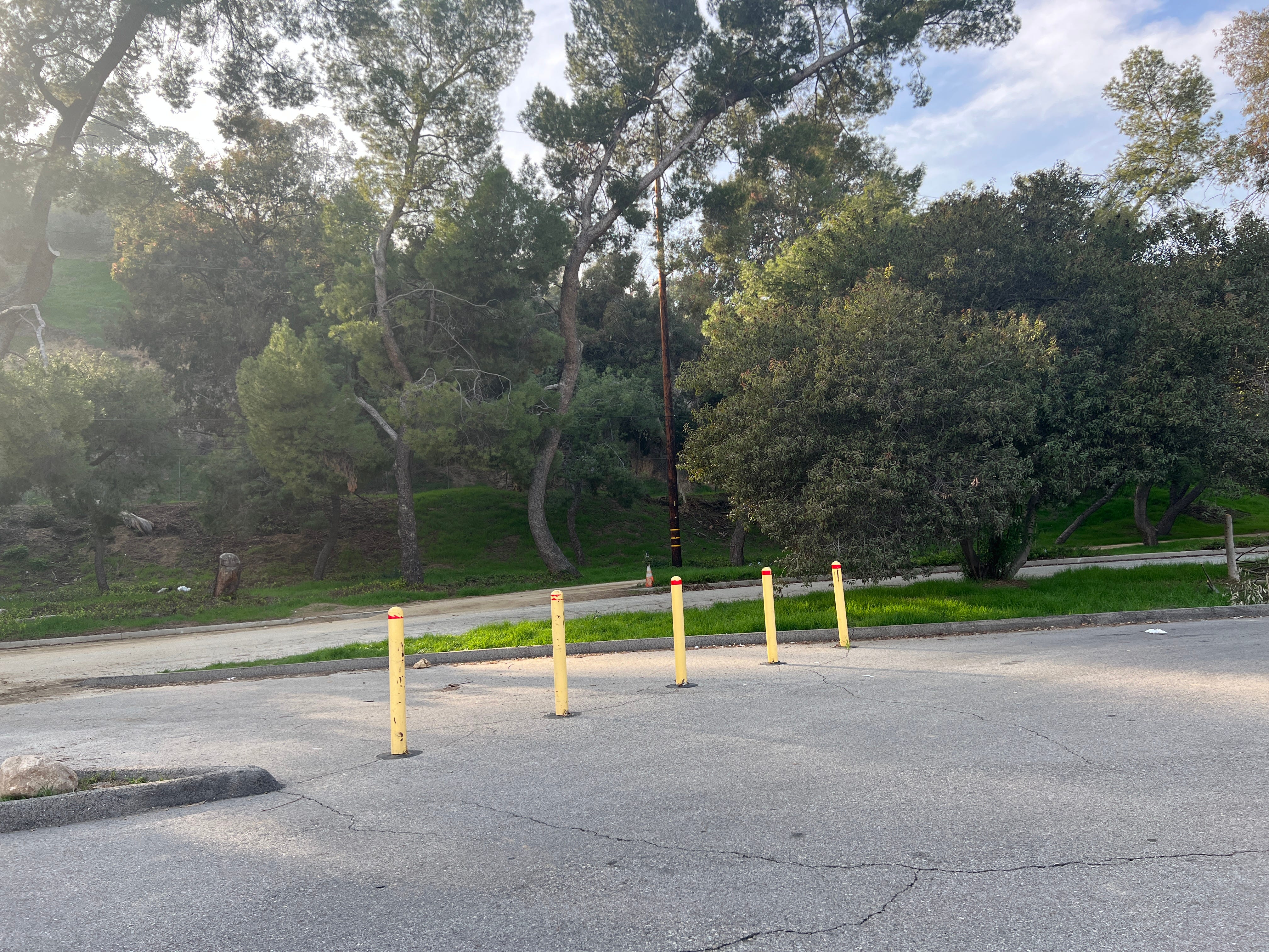
Walk through them, then look across the driveway to the right and you’ll see the path to the trailhead. (Yes, that’s a basketball hoop.)
You’ll come to a fork. Stay left, toward a second driveway.
(Going right is for horses; that leads to one of the many Griffith Park bridle trails.)
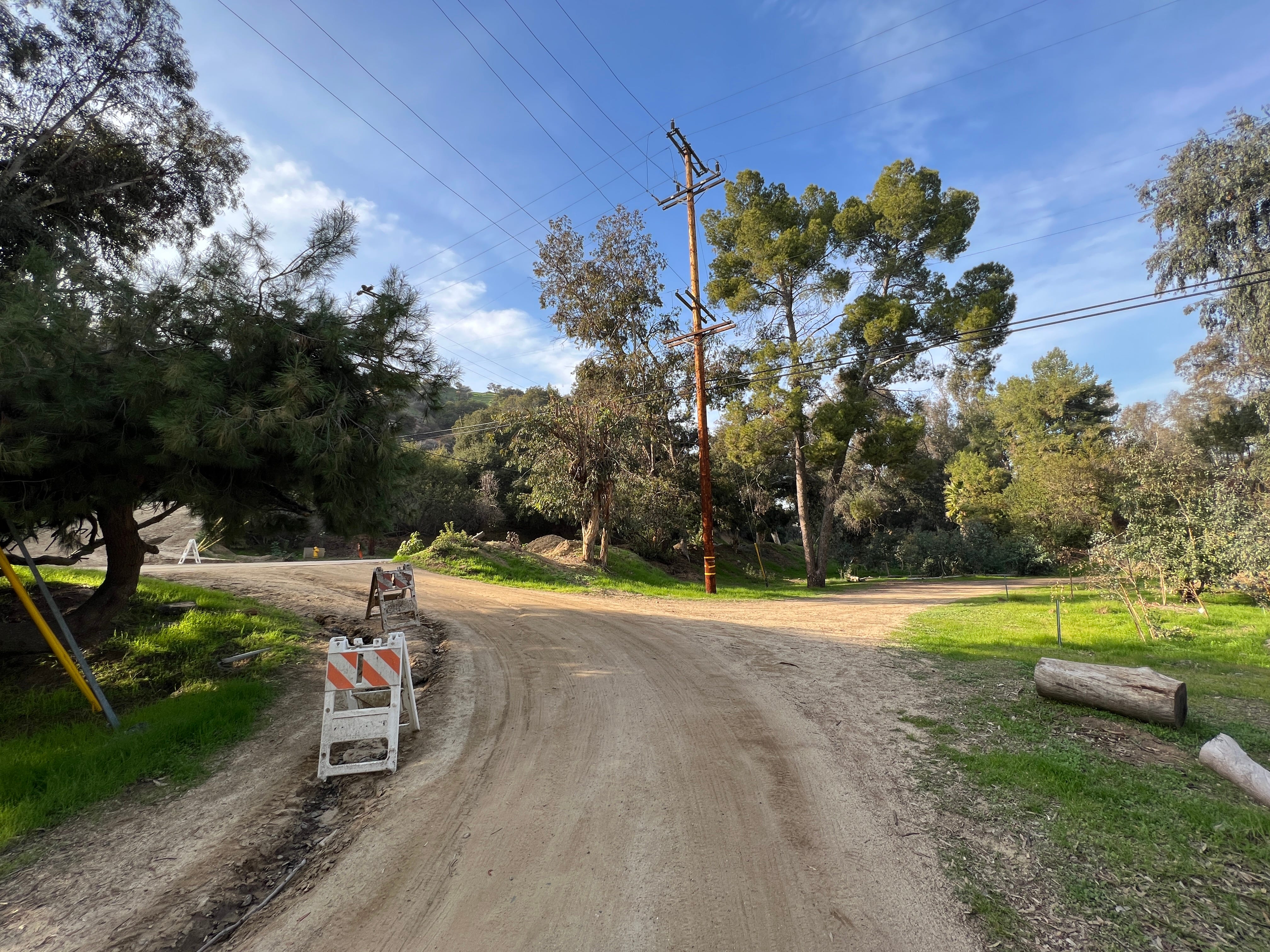
Across that second driveway is the trailhead for the Skyline Trail. It is a little bit steep, but it’s short.
No further fancy instructions, other than when coming from this side of the Skyline Trail, the zoo fence is on the left, and the tree stump you’re looking for is on the right.